Since Labor Day, North America has been hit with an unprecedented wave of natural disasters, from forest fires still raging in California to multiple catastrophic hurricanes in the Atlantic to an earthquake shattering one of the world’s most populated cities. If there is one silver lining from these events, it has been the wide deployment of robots in aiding search, rescue, and recovery efforts. In fact, many take for granted the amazing drone footage that is providing every media news outlet with images from within the epicenter of the hardest hit areas, which are too devastated to be reached by human reporters. To appreciate the breadth of unmanned systems being deployed and the technology on the horizon, a quick review of the last anxiety-ridden months is required.
Even before Hurricane Harvey spiraled into the Gulf of Mexico, underwater drones were sailing hundreds of feet below the water surface to measure the storm’s intensity. The yellow remote-controlled ocean gliders provided the National Oceanic and Atmospheric Administration (NOAA) with critical data, such as water temperature, to enable local, state and federal agencies to better prepare for the incoming torrent. NOAA previously only deployed human-piloted planes that flew into the eye of the storm to take wind measurements; however, these flights missed key readings of the info below to accurately forecast the hurricane’s strength. Zdenka Willis, NOAA’s US Integrated Ocean Observing System Program Director, explained that “When storms are moving along our coasts, lives depend on accurate forecasts. Unmanned gliders sample the ocean in places where it is impractical to send people, and at a fraction of the cost, allowing us to collect data even in the middle of a storm. This information ultimately helps improve forecast precision so that decision makers can keep people safe.”
Once Harvey made landfall with catastrophic winds followed by a deluge of biblical proportions, unmanned systems became a critical communication link between first responders and victims. One of the crews that was on the front lines of search & rescue efforts in Texas was Dr. Robin Murphy, Director of Texas A&M University’s Center for Robot-Assisted Search and Rescue (CRASR). Over a frenzied period of eleven days, Murphy’s team conducted 119 unmanned missions in Houston, aiding first responders with valuable visual data information from the air and water. Dr. Murphy, a vocal advocate for robotic search & rescue systems for over a decade, is pleased that emergency management teams have embraced the technology but also frustrated that it has taken so long. “If you’d told me in 2005, having seen their clear value after Katrina, that it would be 10 years before they were adopted by all of the emergency management systems, I would have laughed. I’m really excited that this may be the time where everybody sees that it’s time to get them in the hands of emergency managers,” exclaims Dr. Murphy. According to the CRASR website, the missions provided the following critical services:
- Realtime “spot checks of situation awareness of people in distress”
- The “extent of flood and tornado damage”
- Number of people that had not been evacuated and access routes to their neighborhoods
- Estimating how long neighborhoods would be cut off from rescue & recovery crews
- Enabling policy makers to dispel rumors and provide accurate footage of the damage
- Systematically record the extent of the “damage for federal disaster relief and future planning”
- Project “river flooding by monitoring the river and confirming river flood inundation models”
- Monitor the “river and condition of over 100 miles of levees through out the county”
In addition to CRASR, there were handful of civilian drone operators providing real-time information feeds and organizing themselves into quasi relief organizations. As an example, “Humanitarian Drones” is a collective of drone professionals from across the USA which provides first responders with real-time “mapping, piloting, processing, cinema, permitting and manufacturing and general [drone] expertise.” U.S. Army Veteran and drone expert Brett Velicovich said this past hurricane season “could be the largest humanitarian drone response in U.S. history.” Velicovich has been volunteering his time to organize with other drone operators to deploy unmanned systems throughout the crisis centers. In early September, he landed in Texas with what he describes as “an Army of drone volunteers ready and willing to support search and rescue efforts and plug into other Harvey response teams already on the ground.” Then his team quickly shifted to Florida, right before Irma hit so they could offer immediate help to local agencies.
Brandon Stark, director of the University of California’s Center of Excellence on Unmanned Aircraft System Safety, stated that Harvey was “one of the first big disasters where we can show how valuable drones can be.” Today, most areas of Puerto Rico remain isolated from rescue workers, without roads, electricity, and cell towers; drones are perhaps the only link to the civilized world. The photo at the beginning of this post was shot by AFP photographer Ricardo Arduengo with a drone. When describing the scene of the twisted road that once was a bustling four-lane highway, Arduengo says “It was shocking. From the air, it looked like an atomic bomb hit.”
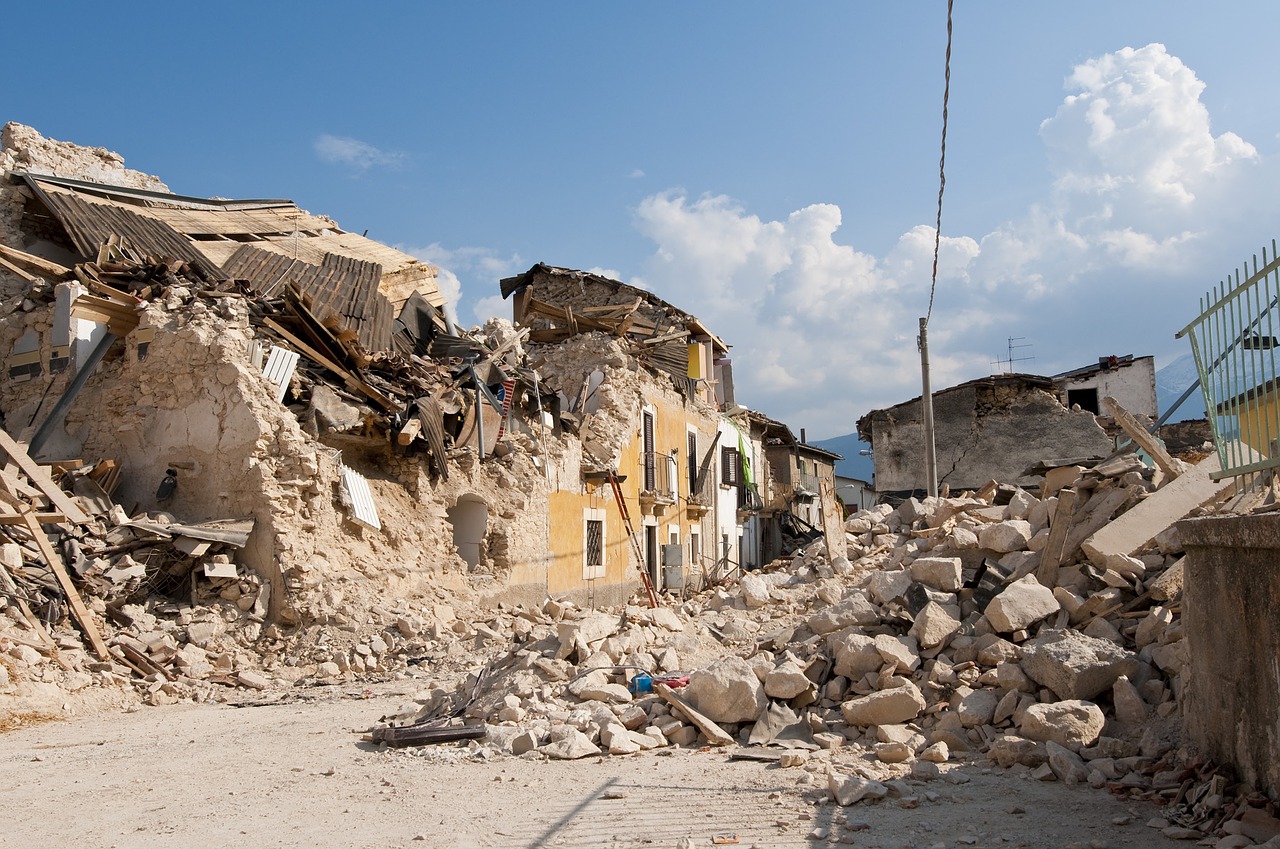
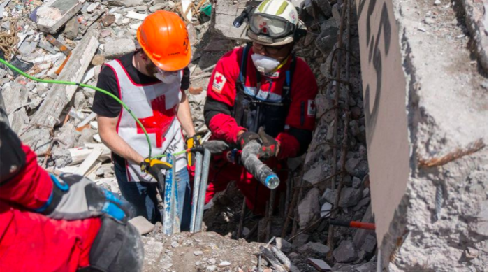
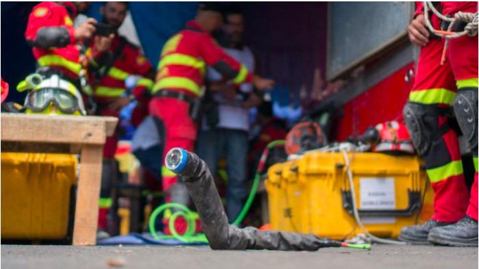
Unfortunately, Mother Nature’s fury was not limited to hurricanes. This past September, Mexico City laid in ruins just days after Harvey when a 7.1 magnitude earthquake shook the capital city, burying many victims under thousands of pounds of rubble. Desperate for help, Mexican businessman emailed famed Carnegie Mellon University Professor, Howie Choset, to use his snake robots to look for survivors. Unfortunately, CMU’s team was alerted to the disaster too late, as Choset explains, “If we’d gone 2 days earlier, maybe we could have had a better impact. You really have 48 hours to find people…We got down there 3 or 4 days after the earthquake. At that point, the likelihood of finding life wasn’t that high, so it was sort of like, ‘Yeah we’ll give you a shot,’ and then after an hour or so, ‘Alright we’re giving up, we’re going to bulldoze the place now.’”
Unfortunately, the snake robot did not find any survivors, however the valuable field experience enabled Choset to walk away with a list of firsthand requirements to evolve his system for future emergency responses. “There were also mobility challenges. These structured environments are insane. Being able to lower the robot in and look around: That we did very well, but at a certain point we want the robot to move like a real snake does, over this harsh terrain. We need to do a lot more, so we’re that much more respectful of what a real snake can do,” noted Choset. In addition, the rescue workers on the ground requested that future versions include more sensors. “At the very least microphones. After the microphones, they wanted a gas sensor, because there was a strong concern that they were going into an environment that could explode,” says Choset. The robot could also use better visualization software and algorithms to traverse obstacles. According to Choset, “The most ideal thing is to build up a 3D map of what you’re seeing as you’re seeing it, and be able to rotate the map around like you’re in the movie The Matrix or playing a video game, and then be able to superimpose gas data and other kinds of sensory information. We’ve developed a sensor head that we didn’t get to use that’s a stereo camera and a laser range finder so you can infer depth information.” Choset is not discouraged by the Mexico City experience as “I have been working on search and rescue for about 20 years.”
The future of robotic emergency response could be an army of humanoid robots that can easily scale ladders, move rubble and scan the area for survivors. Earlier this month, Honda robotics (famous for its mobile Asimo robot) showcased its latest prototype, E2-DR (above). The ER-DR is being marketed as a “disaster response robot” that can walk, traverse rubble/obstacles, climb stairs/ladders, and sink quickly into narrow crevices. The only limitations seem to be its battery life of 90 minutes and weather, as it can withstand wet conditions for a maximum of 20 minutes. However, Honda’s orange beast is equipped with hands that have cameras, 3D sensors, as well as with powerful grippers. It is unclear if Honda’s project will ever be commercialized, however it does provide a vivid picture of the future of robotic search & rescue.
As I write this article, Northern California is raging with wildfires that have claimed the lives of 40 people, in addition to billions of dollars of damage. Over 10,000 firefighters have been deployed to the region, yet unlike robotic systems humans are limited by their own mortality. Last year, Lockheed Martin showcased a complete unmanned aerial firefighting system that is three to five years from full commercialization (some units are available for individual purchase). The Lockheed system includes a quadcopter drone, hand launched remote robot, two unmanned helicopters and robust communication platform between the units. The quadcopter drone, which is the first of the four products to come to market, uses infrared and visible light cameras to pinpoint the source of the fire. It relays this information to an unmanned cargo chopper called K-MAX which was originally built for battle in Afghanistan. Instead of military maneuvers, K-MAX automatically douses the flames of the fire from the air. Using the Desert Hawk surveillance drone, human firefighters will have the ability to survey the area behind the flames for victims. The hand launched drone communicates the survivors’ locations to another unmanned helicopter, SARA, that is controlled by the human firefighter on the ground to safely ferry the trapped humans out of the blaze. While complete unmanned systems are not fully available to help the current situation in Napa Valley, the future of disaster recovery is bright as more robots show up for work.


